High pressure over the Great Basin
A strong high-pressure system builds over Nevada and Utah. Air flows clockwise around it, pushing dry desert air toward Southern California.
We use cookies for essential site functions and, with your permission, for analytics and advertising. California residents can opt out of the sale or sharing of personal information at any time. See our Privacy Policy, Cookie Policy, and Do Not Sell or Share My Personal Information.
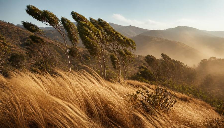
The hot, dry winds that turn a mild day into a fire-danger day — and what they mean for your plans.
Last updated
Santa Ana winds are hot, dry, easterly winds that blow from the inland deserts and mountains toward the Southern California coast, including San Diego. They happen most often from October through March, with a peak in fall and early winter. As the air descends from the mountains, it compresses and heats up, often raising temperatures 15 to 25°F above normal and dropping humidity into the single digits. The gusts can exceed 60 mph in canyons and foothills. The biggest local impacts are wildfire risk, power outages, worsened allergies, dangerous surf, and poor air quality. When the National Weather Service issues a Red Flag Warning, outdoor burning is banned and residents should be ready to evacuate fire-prone areas. Santa Ana days are not ideal beach days — the wind rips up the ocean and creates hazardous rip currents.
| Area | Typical conditions | Main risk | What to do |
|---|---|---|---|
| Coastal canyons | Gusty, warm, very dry | Fire spread, downed trees | Avoid outdoor flames, secure loose items |
| Inland valleys | Hot, dry, hazy | Wildfire, poor air quality | Stay indoors if sensitive, pack go-bag |
| Mountains / foothills | Strongest gusts, warm | Fire, power outages | Have evacuation plan, fuel car |
| Beaches | Warm, windy, rough surf | Rip currents, blown sand | Skip swimming, avoid east-facing beaches |
| Downtown / Coronado | Warm, less gusty | Air quality | Limit strenuous outdoor exercise |
| Desert fringe | Very hot, calm to breezy | Heat stress | Hydrate, avoid midday activity |
Rates and availability change daily, so we link the guide rather than quote a price. Each page compares walkable, short-drive and budget options with parking and resort fees called out.
Santa Ana winds are a pressure-driven weather pattern, not a random hot day. Understanding the mechanics helps explain why they are so dangerous.
A strong high-pressure system builds over Nevada and Utah. Air flows clockwise around it, pushing dry desert air toward Southern California.
The air sinks through canyons and compresses under higher pressure at lower elevations. Compression warms the air and drops its relative humidity.
Gaps like Soledad Canyon, Cajon Pass, and local canyons in East County act as funnels, turning a moderate wind into damaging gusts.
The air starts over the desert, so it arrives with very low moisture. Relative humidity can fall below 10 percent, drying out vegetation in hours.
Santa Ana winds in October and November arrive before winter rains, when brush is at its driest. That combination drives most of Southern California's worst fires.
Less common but still dangerous: spring Santa Ana events can bring heat waves and fire risk before the landscape has greened up.
Red Flag Warnings mean fire weather is critical. Treat them seriously even if the sky looks clear and blue.
Look up your San Diego County evacuation zone before the event. Do not wait for an official order to think about where you will go.
Documents, medications, phone chargers, water, snacks, a change of clothes, and pet supplies. Keep it in the car during red-flag days.
No campfires, no welding, no charcoal grills, no cigarettes tossed from cars. Even a spark on dry brush can start a fast-moving fire.
If an evacuation is ordered, fuel stations can run out quickly. A half-full tank gives you options.
Santa Ana winds stir up dust, pollen, and ash. People with asthma or allergies should limit outdoor time and keep windows closed.
Gusts can turn patio umbrellas, trash cans, and decorations into projectiles. Stow or tie them down before the wind hits.
Even when no fire starts, Santa Ana winds reshape the feel of the city for a few days.
The wind creates choppy, disorganized surf and strong rip currents. East-facing beaches like Windansea and Blacks can be especially rough.
Dry wind carries pollen and dust. Santa Ana events often coincide with spikes in allergy and asthma complaints.
Downed power lines from wind or preemptive public safety power shutoffs can leave neighborhoods without electricity for hours.
A Santa Ana day can jump from 70°F to 90°F overnight. It feels like summer in the middle of winter.
Dust and ash from distant fires can push particulate levels into the unhealthy range, especially in inland valleys.
Strong crosswinds at San Diego International Airport can cause delays and go-arounds, especially for smaller aircraft.
Most often from October through March, with a peak in October, November, and December. They are less common in spring and rare in summer.
The air originates over the hot desert and warms further as it descends through mountain canyons and compresses under higher atmospheric pressure at lower elevations.
A Red Flag Warning is issued by the National Weather Service when critical fire weather conditions — strong winds and low humidity — are expected. Outdoor burning is banned and residents should be prepared to evacuate.
Usually no. The winds create rough, disorganized surf and strong rip currents. Clean conditions return when the winds shift back to onshore westerly flow.
Yes. They stir up dust and pollen and can carry smoke from wildfires. Air quality often drops into the unhealthy range during strong events.
Most events last one to three days. Strong multi-day events can extend to five days, especially in fall.
The hub for understanding San Diego's seasonal quirks, from marine layer to Santa Ana winds.
Why the coast goes gray for weeks and how to plan around it.
What to stock, secure, and know before the next shaker.
When the highest tides of the year flood beaches, piers, and roads.
How to read the coastal cloud forecast and pick the sunny side of town.
Average temperatures and conditions through the year.
Rip currents, wind, and how to stay safe at the shore.
The Sandi Spots Newsletter
New beach finds, hidden taco shops, weekend events, and seasonal guides — once a week from a local. No spam, ever.
One email a week. Unsubscribe anytime.
Published by the Sandi Spots Editorial team at Sleep Coast LLC. Guides combine local perspective and source research. Check the individual guide for firsthand observations and follow official links to confirm current details.