Coast vs. inland is the main divide
The Pacific Ocean cools the coast. The coastal mountain range blocks the marine layer from pushing far inland. That is why Mission Valley and East County often bake while Ocean Beach is gray.
We use cookies for essential site functions and, with your permission, for analytics and advertising. California residents can opt out of the sale or sharing of personal information at any time. See our Privacy Policy, Cookie Policy, and Do Not Sell or Share My Personal Information.
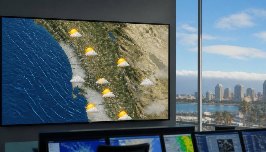
Why the coast goes gray, the wind turns hot, the tides surge, and the ground shakes — and what to do about each.
Last updated
San Diego's weather looks simple — mild and sunny — but it hides five recurring quirks that drive search traffic every year. May Gray and June Gloom are a marine layer that hugs the coast for weeks in late spring, leaving inland neighborhoods sunny while the beaches stay cool and overcast. Santa Ana winds are hot, dry easterly winds that spike fire danger, worsen allergies, and can turn a 75-degree day into a 95-degree day in a few hours. King tides are the highest tides of the year, flooding low-lying spots like La Jolla Shores and Imperial Beach at peak high tide. Marine layer forecasting is the local art of knowing whether the coast will be gray while East County is clear. Earthquake prep matters because San Diego sits near several active fault zones, including the Rose Canyon and Elsinore faults. The guides below break each one down with local forecasts, safety rules, and how to plan around them.
| Phenomenon | When it happens | What it feels like | Local impact |
|---|---|---|---|
| May Gray / June Gloom | Late May through June | Cool, gray, drizzly mornings | Coast stays cloudy; inland is sunny |
| Santa Ana winds | Fall through winter, rarely spring | Hot, dry, gusty | Fire weather, allergies, rough surf |
| King tides | Nov–Feb, peaking Dec–Jan | Extremely high and low tides | Beach flooding, pier closures, photo ops |
| Marine layer | Year-round, worst May–June | Low clouds and fog near coast | Blocks sun, cools beaches, delays flights |
| Earthquakes | Anytime, no season | Sudden shaking | Structural risk, tsunamis near coast |
Rates and availability change daily, so we link the guide rather than quote a price. Each page compares walkable, short-drive and budget options with parking and resort fees called out.
San Diego's geography creates microclimates. The same afternoon can be 62°F and foggy at La Jolla Cove and 88°F and clear in Poway. These guides are built around that split.
The Pacific Ocean cools the coast. The coastal mountain range blocks the marine layer from pushing far inland. That is why Mission Valley and East County often bake while Ocean Beach is gray.
Higher neighborhoods like Rancho Penasquitos and Del Mar Heights can sit above the cloud deck and be sunny when the beach is socked in.
August through October is the warmest, driest, and sunniest stretch at the coast. January and February are the wettest. Spring is the cloudiest.
Onshore flow from the west brings cool, moist air and marine layer. Offshore Santa Ana flow from the east brings heat, dryness, and gusts.
Tide charts are reliable weeks out. Marine layer timing and Santa Ana wind events are harder to pin down until 24 to 48 hours ahead.
Unlike weather, quakes give no useful forecast. Preparation is the only control you have.
Each guide below covers the science, the local forecast, and the practical planning advice for visitors and residents.
Why the coast stays gray for weeks, when it usually burns off, and how to plan beach days and weddings around it.
The fire-season winds that can spike temperatures 20°F in an afternoon, plus what they do to surf, allergies, and power lines.
A San Diego-specific checklist for supplies, securing your home, and knowing what to do during and after shaking.
The highest tides of the year, where they flood, and how to photograph them safely.
How to read the forecast and pick the sunny side of town on a gray coastal morning.
Most weather complaints in San Diego come from expecting one climate and getting another five miles away.
A forecast for 'San Diego' usually references the airport or downtown. If you are going to the beach, look at a coastal station. If you are hiking East County, look inland.
May and June are the riskiest months for outdoor coastal events. August through October are the safest.
The wind whips up surf and rips, and red-flag fire warnings can close trails. Wait for onshore flow for cleaner ocean conditions.
High water can trap people against bluffs at spots like Sunset Cliffs. Check tide tables and carry a retreat route.
San Diego's freeway network can be damaged in a major quake. A small kit in the trunk covers the drive home or an overnight stay.
Even in August, the temperature at the beach can drop 15°F after sunset once the marine layer pushes back in.
May Gray and June Gloom are local names for the persistent marine layer — low clouds and fog — that blankets the San Diego coast from late May through June. The sun is often blocked until late morning or early afternoon, and some days stay gray all day within a mile or two of the ocean.
The marine layer is usually strongest in May and June. It weakens in July and is least common from August through October. Inland areas clear first; the coast can stay gray longer.
Yes. Santa Ana winds bring hot, dry, gusty conditions that dramatically increase wildfire risk. They also worsen allergies, knock down trees and power lines, and create hazardous surf. Red Flag Warnings are common during Santa Ana events.
King tides occur a few times per year, typically November through February, when the sun, moon, and Earth align. The highest tides usually cluster around the new and full moons in December and January.
Yes. The Rose Canyon Fault runs through the San Diego metro area, and the Elsinore and San Jacinto faults are nearby. While large quakes are less frequent than in Los Angeles or San Francisco, the risk is real and preparation is recommended.
Inland valleys and higher elevations usually clear first. Try Poway, Escondido, Ramona, or the inland North County wine country on a gray June morning.
Why the coast goes gray for weeks and how to plan around it.
The hot, dry winds that reshape fire risk, allergies, and beach days.
What to stock, secure, and know before the next shaker.
When the highest tides of the year flood beaches, piers, and roads.
How to read the coastal cloud forecast and pick the sunny side of town.
Average temperatures, rainfall, and what to expect each month of the year.
Where to watch the sun go down once the marine layer clears.
Rip currents, jellyfish, and how to stay safe on the sand.
The Sandi Spots Newsletter
New beach finds, hidden taco shops, weekend events, and seasonal guides — once a week from a local. No spam, ever.
One email a week. Unsubscribe anytime.
Published by the Sandi Spots Editorial team at Sleep Coast LLC. Guides combine local perspective and source research. Check the individual guide for firsthand observations and follow official links to confirm current details.