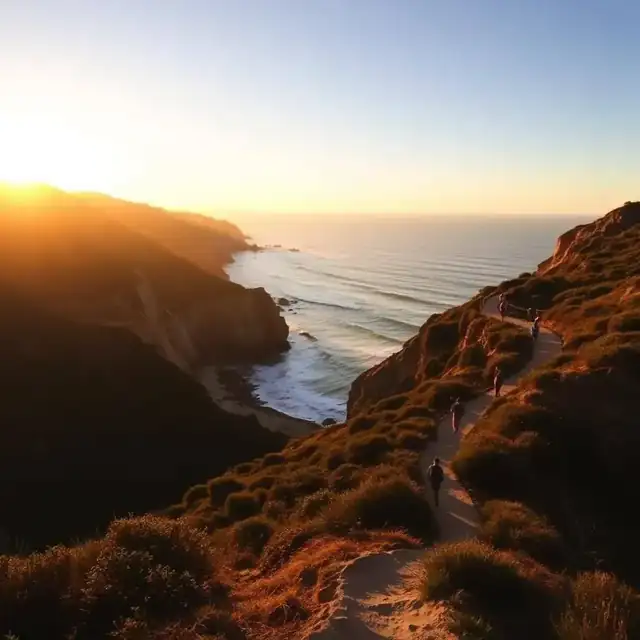
La Jolla / Del Mar · 0.7 mi loop · 50 ft elevation · Dogs: No
The easiest way to experience Torrey Pines' famous sandstone bluffs and ocean views. A flat loop with two overlooks that put the Pacific 300 feet below you. Wheelchair-difficult but stroller-doable on the paved sections.
Best for: First-time visitors, sunset, families
Parking: $15–$25 at the reserve lot. Free street parking on Coast Highway 101 (5-min walk uphill).
Local tip: Go for sunset. The west-facing bluffs light up gold 30 minutes before the sun drops.
La Jolla / Del Mar · 1.5 mi out-and-back · 300 ft elevation · Dogs: No
The signature Torrey Pines hike. Drops through pine-studded sandstone canyons down to Torrey Pines State Beach. You can walk back along the sand at low tide or return up the trail.
Best for: Ending on the beach, ocean views
Parking: Same reserve lot — arrive before 9 AM on weekends or expect a 30–60 min wait.
Local tip: Check the tide chart. Low tide = walk back on the beach past Flat Rock. High tide = return the way you came.
Mission Trails / San Carlos · 3.0 mi out-and-back · 950 ft elevation · Dogs: Leashed
The highest peak inside San Diego city limits (1,593 ft) and the classic local training hike. The summit gives you a 360° panorama from downtown to the Coronado Islands to Mount San Jacinto on clear days.
Best for: Sunrise, highest point in the city
Parking: Free lot at Golfcrest & Navajo. Overflows fast on weekends — arrive by 7 AM or hike after 3 PM.
Local tip: Do it as a sunrise hike in summer. Cool air, empty trail, and the city glowing at your feet.
Poway · 5.8 mi out-and-back · 1,000 ft elevation · Dogs: Leashed
The most popular North County peak. A steady climb through chaparral to a boulder-strewn summit with sweeping views to the ocean. Spring wildflowers (March–April) turn the whole trail purple and orange.
Best for: Wildflowers, dogs, a real workout
Parking: Free lot at CA-67 & Poway Rd. Full by 8 AM on weekends.
Local tip: Zero shade. Start before 8 AM in summer or after 4 PM. Bring 2 liters of water minimum.
Poway / Ramona · 7.3 mi out-and-back · 2,000 ft elevation · Dogs: Leashed
The most photographed hike in San Diego County — a thin slab of granite jutting off the summit that everyone poses on. The hike itself is a strenuous climb with almost no shade. Line for the rock photo can be 45+ minutes on weekends.
Best for: Instagram, bragging rights
Parking: Lake Poway lot ($10 on weekends for non-residents) or free at Highway 67 trailhead (shorter, steeper approach).
Local tip: Weekday morning if you want the photo without waiting. Bring gloves for the boulder scramble at the top.
Point Loma / Ocean Beach · 1.5 mi one-way (any length) · 50 ft elevation · Dogs: Leashed
Not really a hike — a bluff-top walking path along one of the most dramatic stretches of California coastline. Sandstone arches, hidden coves, blowholes, and the best sunset in the county. Stay behind the fences (the cliffs collapse).
Best for: Sunset, casual walk, tide pools
Parking: Free street parking along Sunset Cliffs Blvd. Fills 45 min before sunset.
Local tip: Walk south from Ladera Street for the best cliff formations. Bring a headlamp if you stay past sunset.
Solana Beach / Encinitas · 2.2 mi loop · 150 ft elevation · Dogs: No
A miniature slot canyon in San Elijo Lagoon that squeezes down to shoulder-width in spots. Bring smaller hikers and expect a metal ladder finish. Loops back through the lagoon on flat wetlands trail.
Best for: Kids, slot-canyon novelty, quick adventure
Parking: Free lot at Solana Hills Dr & Santa Helena. Small — arrive before 9 AM weekends.
Local tip: Not for anyone claustrophobic or wider than the slot (roughly 18 inches). Alternate return trail is available.
Cleveland National Forest / Descanso · 4.0 mi out-and-back · 1,000 ft (mostly downhill first) elevation · Dogs: Leashed
A three-tiered waterfall an hour east of San Diego. The trick: the hike DOWN is the easy part; the climb back OUT in full sun is what breaks people. Rangers extract multiple hikers every summer weekend.
Best for: Swimming holes after winter rain
Parking: Free at Boulder Creek Rd trailhead. Adventure Pass may be required.
Local tip: Winter and spring only (Dec–April). Never attempt in summer heat. Bring more water than you think.
Cleveland National Forest / Ramona · 5.5 mi out-and-back · 1,100 ft elevation · Dogs: No
An 80-foot waterfall dropping into a swimming pool. Requires a $10 permit (recreation.gov) and closes June–September due to heat rescues. The return climb is 1,100 vertical feet in direct sun.
Best for: Swimming pool at the bottom (cool months)
Parking: Free at Thornbush Rd trailhead — permit required.
Local tip: Book the permit 1–2 weeks ahead for weekends. Start by 7 AM even in cool months.
La Jolla · 1.0 mi out-and-back · 300 ft (steep) elevation · Dogs: No
Not an official trail — an unmarked, eroded sandstone chute down the cliffs to Black's Beach. Requires hand-over-hand scrambling in a few spots. Not for kids, not for anyone unsteady.
Best for: Locals' shortcut to Black's Beach
Parking: Free along La Jolla Farms Rd (residential — read signs).
Local tip: Go down easy, up hard. Wear grippy shoes. Do not attempt in the rain — the sandstone turns to soap.
Point Loma · 2.5 mi out-and-back · 300 ft elevation · Dogs: No
Drops from the Cabrillo lighthouse down the east side of Point Loma with front-row views of downtown, Coronado, and Navy shipyards. WWII bunkers dot the trail. December–March you can spot gray whales from the overlooks.
Best for: History, harbor views, whale season
Parking: $20 vehicle fee at Cabrillo National Monument (valid 7 days).
Local tip: Pair with the tide pools at Cabrillo (best at low tide, October–March).
Mira Mesa / Rancho Peñasquitos · 6.8 mi out-and-back to waterfall · 200 ft elevation · Dogs: Leashed
A flat, shaded canyon that follows a creek to a modest waterfall. One of the few genuinely dog-friendly and mostly-shaded hikes in San Diego. Popular with trail runners and mountain bikers.
Best for: Dog walking, mountain biking, easy long walk
Parking: Free at Sorrento Valley Blvd or Black Mountain Rd trailheads.
Local tip: Waterfall only flows meaningfully December–April. Otherwise the destination is the canyon itself.
Poway · 3.4 mi out-and-back · 1,300 ft elevation · Dogs: Leashed
The steeper, shorter way to the top of Mt. Woodson (and Potato Chip Rock). Trades distance for grade — you gain 1,300 feet in 1.7 miles. Locals' preferred approach.
Best for: Same summit as Potato Chip Rock, half the distance
Parking: Small dirt pullouts on Highway 67 — arrive early.
Local tip: Combine with Potato Chip photo. Down the Lake Poway side, arrange a car shuttle.
Poway · 2.7 mi loop · 300 ft elevation · Dogs: Leashed
A rolling loop around Lake Poway with picnic-friendly stops and shaded spots to fish. Kids handle it easily. Connects to the Mt. Woodson trail if you want to add a hard extension.
Best for: Families, dog walks, easy morning loop
Parking: $10 on weekends for non-residents; free weekdays.
Local tip: Rent a rowboat or kayak at the lake after your loop — kids love it.
Julian · 4.5 mi out-and-back · 1,300 ft elevation · Dogs: Leashed
The best fall hike in the county. Oak and pine forest that actually turns gold in November, and a summit view stretching from the ocean to the Salton Sea. An hour drive to Julian is part of the appeal.
Best for: Fall colors, escape the heat, apple pie after
Parking: Free at Farmer Rd trailhead.
Local tip: October–November for color. Combine with apple pie at Julian Pie Company on the way home.
Cuyamaca Rancho State Park · 5.8 mi out-and-back · 1,650 ft elevation · Dogs: Leashed (paved section)
The second-highest peak in San Diego County (6,512 ft). Paved fire road all the way up — steady but never technical. On clear winter days you can see Mexico, the Salton Sea, and snow on the summit itself.
Best for: Second-highest point in the county, snow in winter
Parking: $10 day-use fee at Paso Picacho campground.
Local tip: Only local hike where snow is common (Dec–Feb). Check road conditions after storms.
Lakeside · 11.4 mi out-and-back · 3,600 ft elevation · Dogs: Leashed
Nicknamed "El Cap" — the hardest official hike in the county. Multiple false summits, 3,600 vertical feet, zero shade. Locals train for Whitney and Kilimanjaro here. Not a casual visitor hike.
Best for: Beast-mode training, ultra-runners
Parking: Free at Blossom Valley Rd trailhead — small lot.
Local tip: Start by 5 AM in warm months. Bring 3+ liters of water. Do not attempt if you're new to hiking.
Carlsbad · 3.4 mi out-and-back (flat) · 0 ft elevation · Dogs: No
A flat wetlands trail along the north shore of Batiquitos Lagoon. Great for birders — herons, egrets, and ospreys year-round. Stroller and wheelchair accessible on the packed-dirt path.
Best for: Birdwatching, stroller-friendly walks
Parking: Free lot at Gabbiano Ln.
Local tip: Combine with a stop at The Crossings golf course clubhouse for lunch with a view.