Chula Vista Bayfront
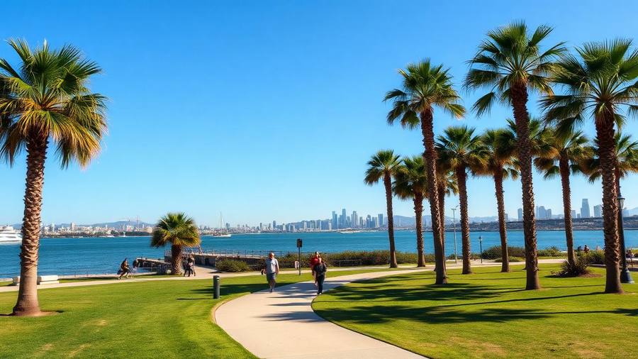
Bayside Park and the Bayshore Bikeway give you flat waterfront paths, skyline views, and a fishing pier, with a major resort and convention development reshaping the shoreline.
We use cookies for essential site functions and, with your permission, for analytics and advertising. California residents can opt out of the sale or sharing of personal information at any time. See our Privacy Policy, Cookie Policy, and Do Not Sell or Share My Personal Information.
The county's most binational stretch: bayfront parks, the quietest beach in the county, and food you won't find north of the 8.
Last updated
South Bay covers everything between downtown San Diego and the Mexican border: National City, Chula Vista, Bonita, Imperial Beach, and San Ysidro. It's the most binational part of the county, with a majority-Latino population, deep Filipino communities in National City and Chula Vista, and daily cross-border movement through the San Ysidro port of entry — the busiest land border crossing in the Western Hemisphere. Highlights include the Chula Vista Bayfront and its new waterfront development, the Living Coast Discovery Center, the Sweetwater and Otay reservoirs for fishing and hiking, Imperial Beach's quiet wide sand and the Tijuana Estuary, and the Chula Vista Elite Athlete Training Center. Food is the real draw: birria, mariscos, Filipino turo-turo counters, and some of the best taquerias in the county sit on National City's Highland Avenue and Chula Vista's Third Avenue. Housing is more affordable than the coast, and the trolley Blue Line connects most of the area to downtown.
| Area | Known for | Notes |
|---|---|---|
| Chula Vista | Bayfront, suburbs, Third Ave dining | Second-largest city in the county |
| National City | Filipino food, Highland Ave taquerias | Closest to downtown |
| Imperial Beach | Quiet wide beach, estuary, pier | Water quality varies after rain |
| Bonita | Horse trails, golf, quiet suburbs | Semi-rural pocket |
| San Ysidro | Border crossing, outlets | Trolley terminus |
Rates and availability change daily, so we link the guide rather than quote a price. Each page compares walkable, short-drive and budget options with parking and resort fees called out.
Bayside Park and the Bayshore Bikeway give you flat waterfront paths, skyline views, and a fishing pier, with a major resort and convention development reshaping the shoreline.
A small bayfront nature center on the Sweetwater Marsh refuge with sea turtles, rays, raptors, and marsh trails. It's a genuinely good two-hour family stop and far cheaper than the big parks.
The southernmost beach town in California: a wide, uncrowded beach, a pier, and the Tijuana River National Estuarine Research Reserve, which is one of the best birding sites on the coast.
Fishing, hiking, and mountain biking within 20 minutes of the bay, with far fewer people than coastal trails. Check the seasonal schedules — access days vary.
National City's Highland Avenue and Chula Vista's Third Avenue are the two corridors worth a dedicated food crawl: birria, mariscos, Filipino lunch counters, and long-running family taquerias.
The Blue Line Trolley runs from downtown through National City and Chula Vista to San Ysidro, making the border and most of South Bay reachable without a car.
San Ysidro and Otay Mesa are the two ports of entry. Walking across at San Ysidro is straightforward; the northbound return line is the variable and can exceed two hours at peak times.
Imperial Beach and the southern shoreline are affected by Tijuana River sewage flows, especially after rain. Check county water-quality advisories before swimming — closures are frequent in winter.
South Bay is among the more affordable parts of the county, with newer construction in eastern Chula Vista and older, cheaper stock in National City and western Chula Vista.
Coastal South Bay stays mild like the rest of the coast; eastern Chula Vista and Otay Ranch run noticeably warmer in summer.
The area south of downtown toward the border: National City, Chula Vista, Bonita, Imperial Beach, and San Ysidro. It's the county's most binational region.
Yes, especially for food. Highland Avenue in National City and Third Avenue in Chula Vista have outstanding Mexican and Filipino food, plus the Chula Vista Bayfront, the Living Coast Discovery Center, and Imperial Beach's estuary.
It depends on the day. Tijuana River sewage flows cause frequent closures, especially after rain. Check the county's water-quality advisories before getting in.
Yes. The Blue Line Trolley runs from downtown San Diego to the San Ysidro terminus at the border, and you can walk across from there.
Generally yes. Housing in National City and western Chula Vista is among the most affordable in the county, with newer and pricier construction in eastern Chula Vista and Otay Ranch.
Parks, splash pads, and the family-day itinerary.
Crossing, food, and the return-line reality.
The countywide guide when you want to head back toward the coast.
Where these inland roads lead — Julian, the desert, and the mountains.
The Sandi Spots Newsletter
New beach finds, hidden taco shops, weekend events, and seasonal guides — once a week from a local. No spam, ever.
One email a week. Unsubscribe anytime.
Published by the Sandi Spots Editorial team at Sleep Coast LLC. Guides combine local perspective and source research. Check the individual guide for firsthand observations and follow official links to confirm current details.